Mapas de España


Description of Mapas de España
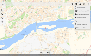
Mapas de España is a geographical information system (GIS) application that provides users with access to various maps and routes across Spain. Designed for the Android platform, the app is particularly useful for outdoor enthusiasts who wish to explore national parks, plan excursions, and navigate routes without requiring an internet connection. Users can download Mapas de España to access a range of features that facilitate outdoor activities such as hiking, cycling, running, and skiing.
The app utilizes cartography from the National Geographic Institute, ensuring that users have access to detailed and accurate maps. These maps include information pertinent to various outdoor activities, enhancing the user experience when planning excursions. Users can save maps offline, allowing for easy access during trips to areas without mobile coverage. This feature is particularly valuable for those who frequently venture into remote regions.
GPS location services are integrated into the app, enabling users to determine their precise location even in areas lacking mobile data. This functionality is essential for ensuring safety and navigation accuracy while exploring unfamiliar terrains. The application also supports tracking routes with GPS, allowing users to record their movements and create a log of their outdoor adventures.
Users have the ability to save and view tracks in multiple formats, including GPX, KML, and KMZ. This flexibility ensures that users can share their routes with others or import them into different mapping software for various uses. The app also supports WMS and WMTS map services, allowing users to utilize the application as a WMS viewer for enhanced mapping capabilities.
Mapas de España incorporates the CartoCiudad project services, which assist users in locating specific places. This feature is particularly helpful for those unfamiliar with their surroundings or when seeking points of interest during excursions. Additionally, the app offers positioning visualization, providing users with information such as coordinates, heading, speed, altitude, and distance calculations.
The application is available in multiple languages, including Spanish, Catalan, Galician, Basque, and English. This accessibility makes it suitable for a diverse user base, allowing both local and international users to benefit from its features. By offering the app in several languages, it accommodates a wider audience and enhances usability for non-Spanish speakers.
Mapas de España is built on OruxMaps software, which is known for its capabilities in managing and displaying geographical information. This foundation allows the app to provide a robust experience for users seeking reliable mapping tools. The app’s design is focused on providing essential features without overwhelming users with excessive options, making it straightforward to navigate.
For users interested in exploring national parks or undertaking the Camino de Santiago, the app provides predefined routes that can guide them through these popular trails. This functionality aids in trip planning and helps users stay on track during their outdoor activities. Additionally, the app allows for the creation of custom tracks, enabling users to devise their own routes based on personal preferences or specific destinations.
The app's offline map mode is particularly beneficial for those who wish to avoid data charges or who may not have reliable mobile service during their travels. Users can save maps in advance, ensuring they have access to necessary navigation tools without the need for continuous internet connectivity. This feature supports a wide range of outdoor activities, making it a versatile tool for various user needs.
Positioning visualization enhances the user experience by allowing individuals to track their progress in real-time. Knowing their speed, altitude, and distance traveled adds an extra layer of information that can be useful for planning future excursions or assessing physical performance during activities. This feature is especially advantageous for athletes and fitness enthusiasts who aim to monitor their outdoor performance closely.
Mapas de España serves as an essential resource for professionals such as police officers, forest guards, and firefighters, who rely on accurate mapping tools for their work. The app’s capabilities extend beyond recreational use, making it a valuable tool for various sectors that require reliable geographical information.
With its combination of detailed mapping, GPS tracking, and offline capabilities, Mapas de España is designed to meet the needs of a wide array of users. The app ensures that outdoor enthusiasts and professionals alike can navigate Spain’s diverse landscapes with confidence and ease. Whether planning a hike, cycling route, or simply exploring new areas, users can rely on this app to provide the necessary tools for a successful outdoor experience.
For additional information and resources, users can refer to the Spanish government's official site: https://www.ign.es/web/ign/portal.
Mapas de España - Version 4.0.0
(11-12-2024)

Mapas de España - APK Information
APK Version: 4.0.0Package: com.orux.oruxmapsIGNLatest Version of Mapas de España
Other versions


 4.15
4.15


Apps in the same category
 3.694.324.074.014.39
 2.83.67